
Back to Learning Center

Learning Center / Model Parameters / Surface & Precipitation

Surface Wind Gusts

The strongest expected short bursts of wind.

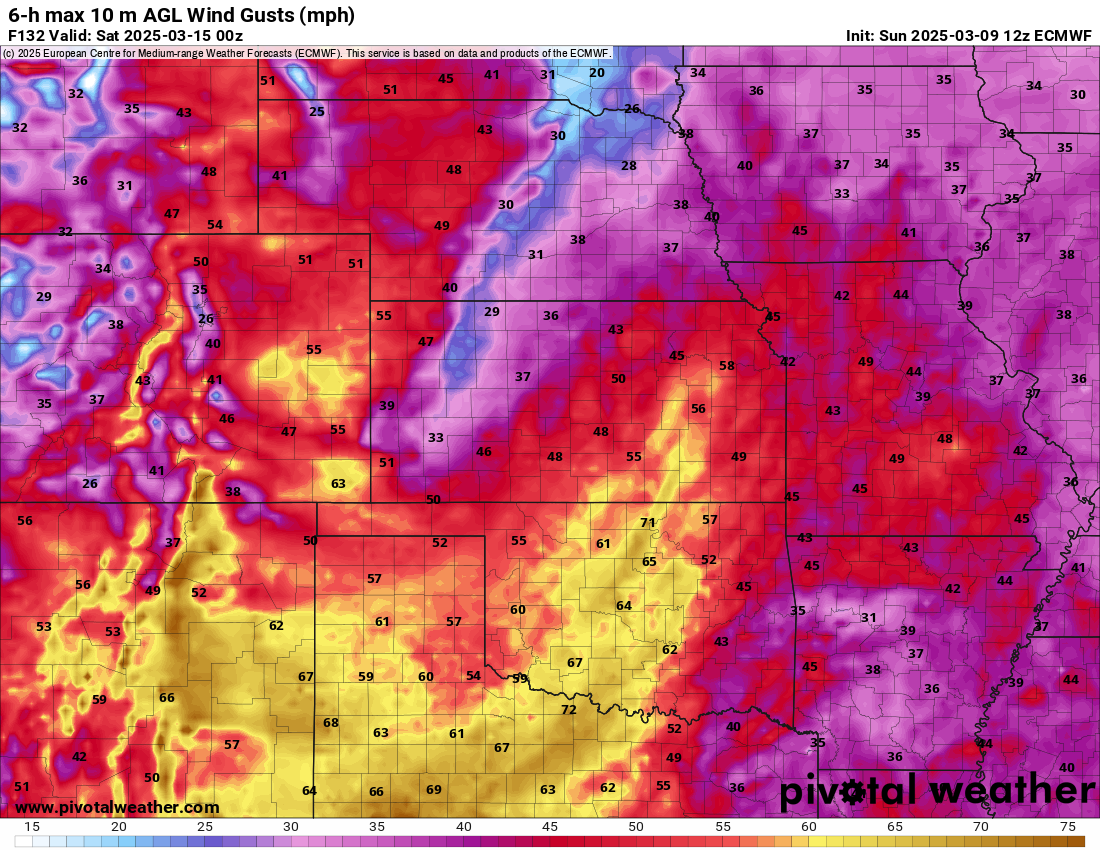
ECMWF 6-hour maximum wind gust map of the central United States showing gusts of 60 to 70+ mph across Kansas, Oklahoma and Texas
6-h max 10 m wind gusts (mph) showing a widespread high-wind event across the Plains, from the ECMWF model. Init: Sun 2025-03-09 12z, valid Sat 2025-03-15 00z.

What the map shows

Areas at risk of damaging or travel-impacting winds.

How to read the colors

Cool colors are light gusts; yellows, oranges, and reds mark 40–60+ mph.

Common mistakes

  • Taking single-point extreme gusts literally — look for patterns.
  • Forgetting thunderstorm gusts are often underforecast by coarse models.

Key terms

Open in Pivotal Weather