
Back to Learning Center

Learning Center / Model Parameters / Surface & Precipitation

Surface Wind & Mean Sea-Level Pressure

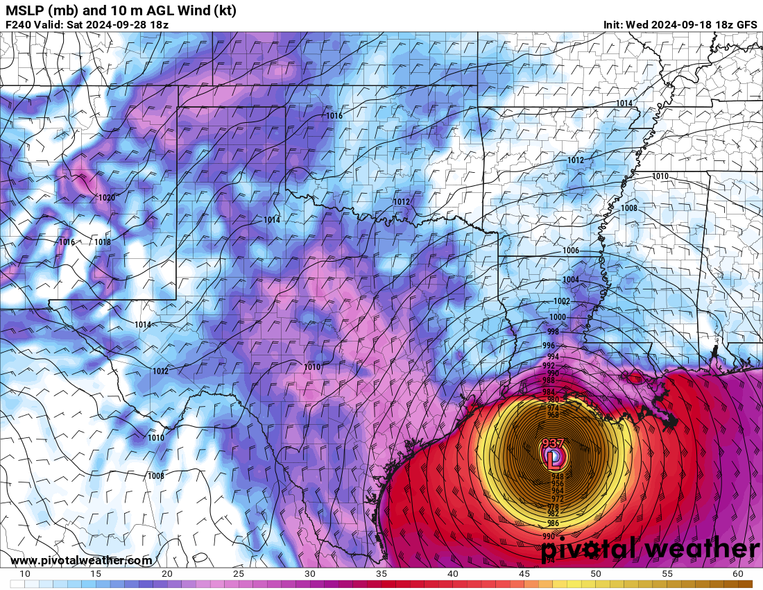
Surface pressure with high and low centers, isobars and wind.

GFS surface pressure and wind map showing a forecast hurricane in the Gulf of Mexico with tightly packed isobars and a 937 mb low center
Mean sea-level pressure (mb) and 10 m wind (kt) with a hurricane forecast in the Gulf, from the GFS model. Init: Wed 2024-09-18 18z, valid Sat 2024-09-28 18z.

What the map shows

Where storm systems and fronts are, and how windy it may be.

How to read the colors

Contour lines labeled in mb with wind shading or barbs. H and L mark centers.

Common mistakes

  • Judging storm strength by central pressure alone without upper-level context.

Key terms

Open in Pivotal Weather