
Back to Learning Center

Learning Center / Model Parameters / Surface & Precipitation

Precipitation Type & Rate

Rain, snow, sleet, or freezing rain, and how hard it is falling.

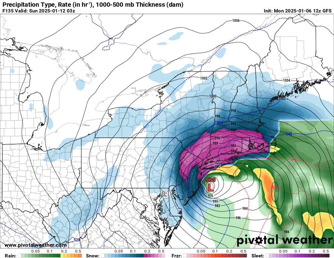
GFS precipitation type map of the East Coast showing a powerful nor'easter with snow inland, rain near the coast, and a mix of sleet and freezing rain in between
Precipitation type and rate (in/hr) with 1000–500 mb thickness, showing a nor'easter off the Mid-Atlantic, from the GFS model. Init: Mon 2025-01-06 12z, valid Sun 2025-01-12 03z.

What the map shows

Where precipitation changes from one type to another and where it is heaviest.

How to read the colors

Green for rain, blue for snow, pink for freezing rain, and orange or purple for sleet; darker shades fall harder.

Common mistakes

  • Trusting a sharp rain/snow line exactly — it often shifts.
  • Ignoring warm noses that only soundings reveal.

Key terms

Open in Pivotal Weather