What the map shows
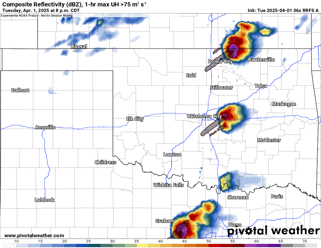
Which model storms are strongest and which ones rotate. The gray-brown swaths mark where 1-hour maximum updraft helicity topped 75 m²/s² — a supercell signal.
How to read the colors
Reflectivity uses the usual radar scale: greens are light, yellows moderate, reds and purples intense. The overlaid swaths highlight rotating updraft tracks.
Common mistakes
- Reading a UH swath as a tornado path — it marks rotation in the updraft, not a damage path.
- Expecting exact storm locations — focus on the areas of concern, not single cells.