
Back to Learning Center

Learning Center / Model Parameters / Upper Air: Heights, Winds & Temps

Temperature, Heights & Winds

Air temperature above the ground at a chosen level.

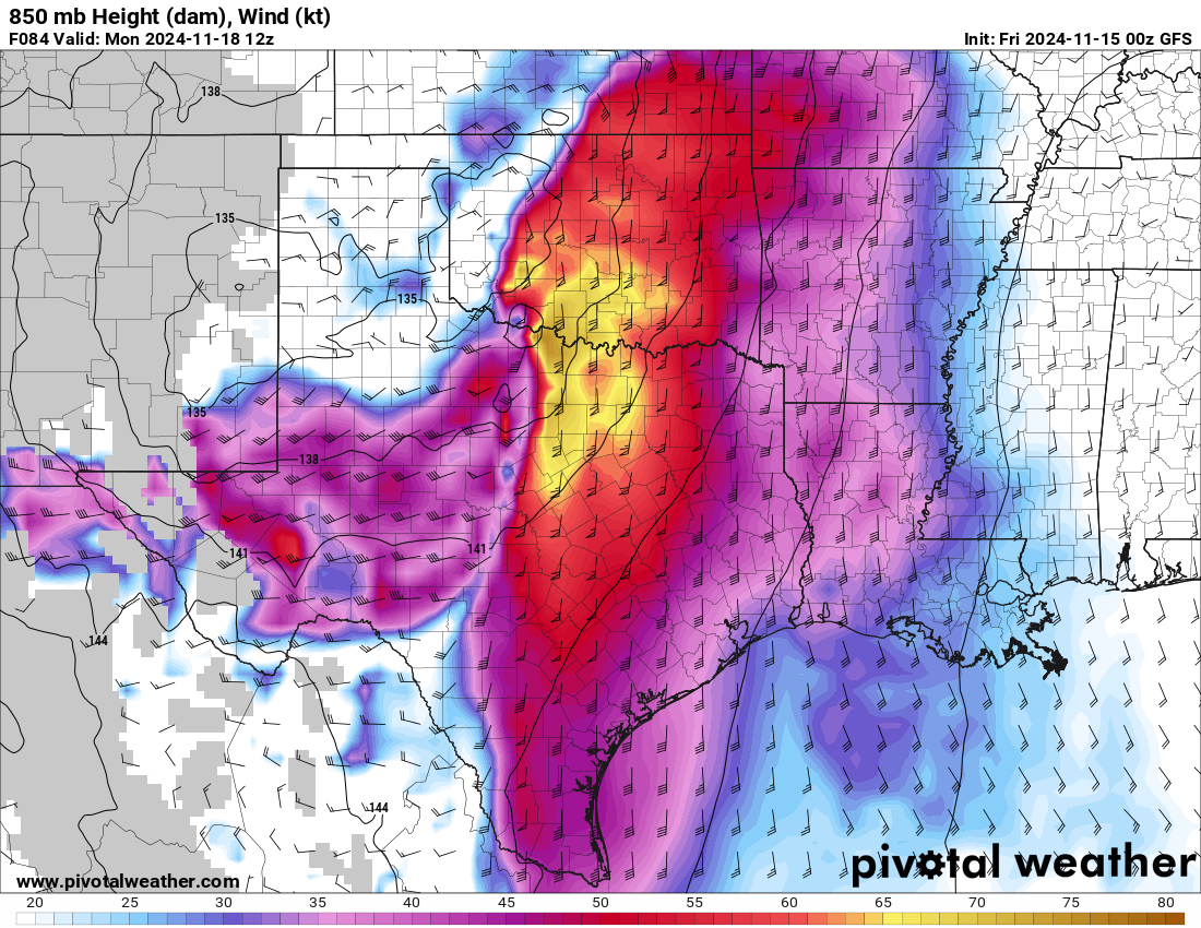
GFS 850 mb height and wind map showing a strong low-level jet from Texas across Oklahoma into the Midwest
850 mb height (dam) and wind (kt) with a strong low-level jet across Oklahoma and Texas, from the GFS model. Init: Fri 2024-11-15 00z, valid Mon 2024-11-18 12z.

What the map shows

Warm and cold air masses aloft. The 850 mb 0°C line is a classic rain/snow guide.

How to read the colors

Blues below 0°C, reds above; wind barbs show flow.

Common mistakes

  • Assuming a cold 850 mb means snow — check the whole column.

Key terms

Open in Pivotal Weather